About "Contour lines"
Here you learn how contour lines represent different formations and details in the terrain. You also learn what the contour interval is.
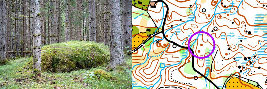
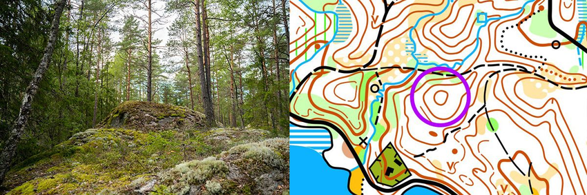
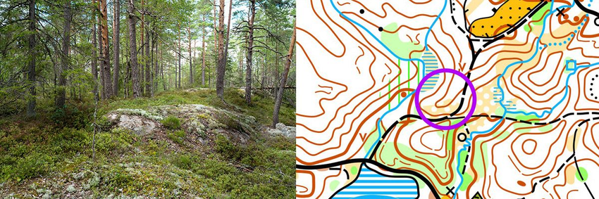
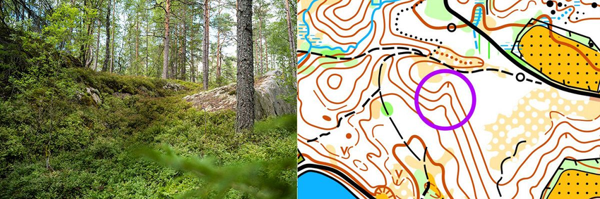
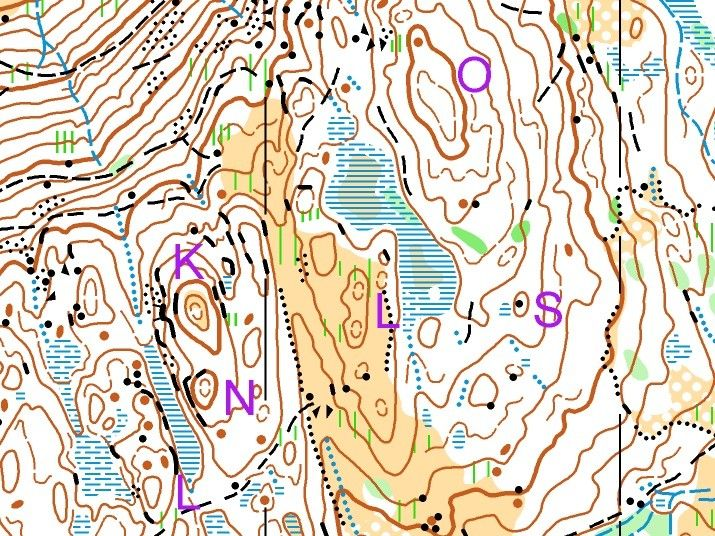
Terrain formations
The brown lines on the map are called contour lines. They tell you where the terrain goes uphill and downhill and whether it is steep or flat. When you learn to read contours, you can see terrain formations like hills, valleys, knolls, pits, ridges and reentrants. Click the buttons to see different terrain formations.
Practice reading the contour picture
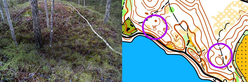
Hills can be good checkpoints – you usually get a better overview of the terrain if you climb these small tops. Contour reading may seem tricky for beginners, but it becomes exciting as you start to master it. Click the buttons to see how contour lines represent different terrain formations.
.svgz-XkMXRPi_n9.jpg)
.svgz-LjSIRF4h9q.jpg)
.svgz-RNb7edcWcl.jpg)
.svgz-70cBF2ok6r.jpg)
.svgz-fVP4KYZN76.jpg)
.svgz-of4YPUcTVg.jpg)

Tips
A ridge can be a good line feature, and so can a long reentrant.
Contour interval
Each contour line is drawn through places at the same height above sea level. Between two contour lines there is a fixed vertical distance called the contour interval. Usually this is 5 meters. This means there is a 5‑meter height difference between two neighbouring contour lines. Every fifth contour line is often drawn thicker. This improves the visual impression of the terrain and makes it easier to judge height differences.
Flat terrain
Sometimes the contour interval is 2 meters. Then the terrain is often quite flat.
Drag the slider. It is easier to see the terrain formations on the map over flat terrain when the contour interval is 2 meters and helper contours are added. On the map with few contour lines the contour interval is 5 meters.
Different terrain formations
Look at this simplified drawing of an island and the map below.
Imagine the water rises 5 meters; then the shoreline reaches the first contour line. Every time the water rises 5 meters it reaches a new contour line. If the water rises 20 meters we get two smaller islands. On the west side of the island there are numbers on each contour line. These are the heights above sea level. The left top is therefore 45 meters above sea level.
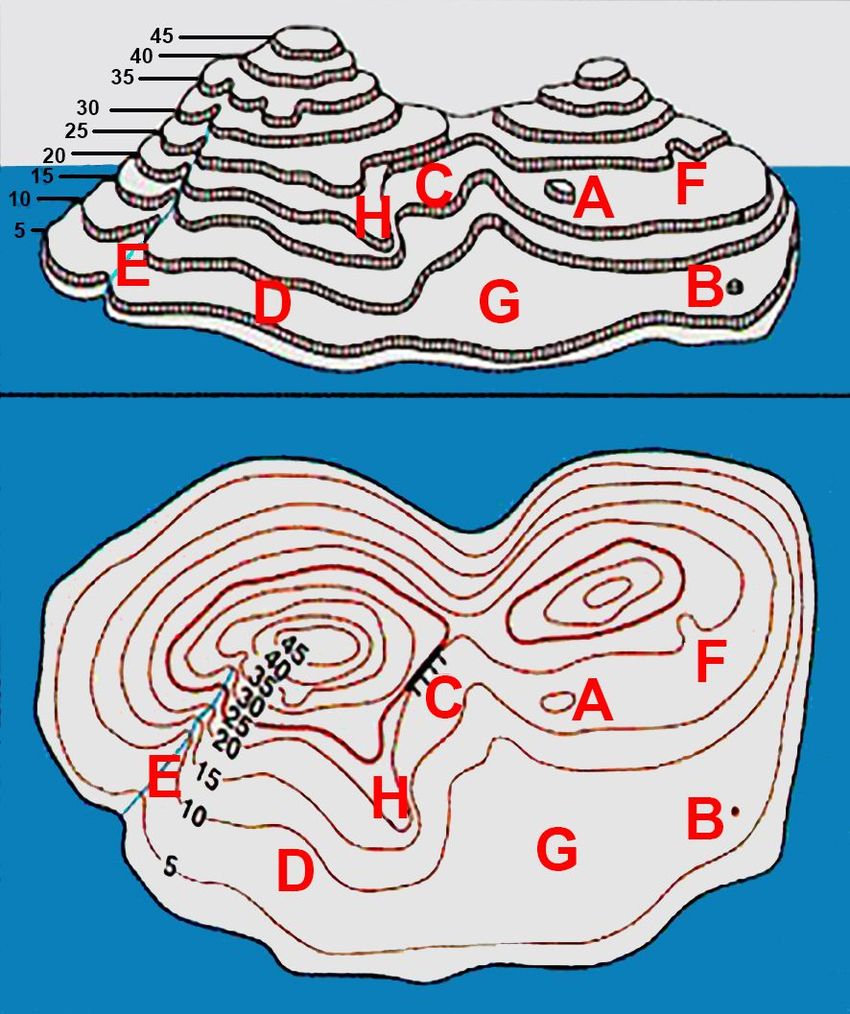
A is a 5‑meter high hill
B is a knoll
C is a steep area with a cliff
D is a gentle slope
E is a long reentrant with a stream
F is a smaller reentrant
G is a flat area
H is a ridge
Find the word!
Read the descriptions in order 1–6, find and remember the letters from the answers. They will form a word.
- The eastern and western sides of the hill are steep.
- The hill is steepest on the western side.
- The hill is elongated with a knoll on its northern end.
- There are two equally high points on this hill.
- The hill is steep in the northeast and southwest.
- On top of this hill is a boulder.
ShowHide answer
Simple contour‑reading orienteering
You are at control 1, the knoll. The next control is in the reentrant down to the right. Drag the slider to see how you can use contour lines to find your way:
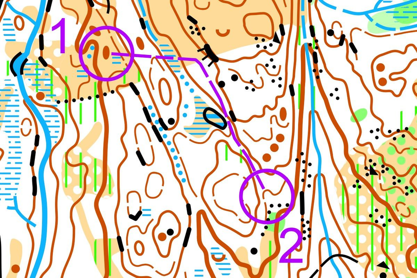
Go on a compass bearing toward the cliff, along the way you have a knoll on your left and a hill on your right. Follow the contour southeast until you get to a cliff on your left and a marsh on your right. Continue in the same direction. You still have a higher hill to your left and a slightly smaller, gentler one to your right. Continue between the hills and down to the control in the reentrant.
What have you learned?
Answer all questions correctly and win a gold medal!
What do contour lines tell you?
What is the contour interval?
When contour lines are close together the terrain is …
When there is a long distance between contour lines the terrain is …
If you move along a contour line you are always …
Which of these terrain formation are shown with contour lines?
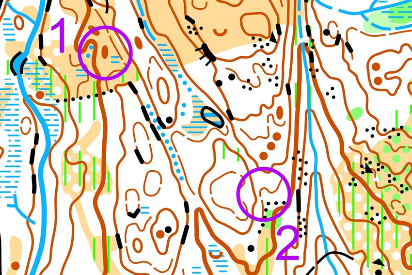
How does the terrain go from control 1 to 2?
.svgz-bnhSEIu9Mm.jpg)
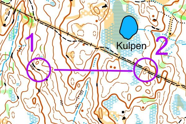
How does the terrain go from control 1 to 2?

Activities
Play: Landscape Building (Activity Bank)
With orienteering map: Line Orienteering (Activity Bank) Adaptation: Draw a line that passes through various contour details and place the controls on these.