About “Courses and scale”
Here you learn which symbols are used to draw a course. You also learn what scale is, making it easier to compare distances on the map with distances in the terrain.
Courses – controls and other symbols on the map
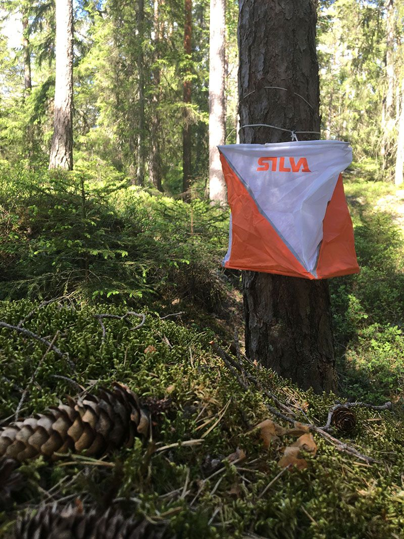
The places you need to find are called controls and are marked with a circle on the map. In the centre of the control circle there is a feature that is easy to see in the terrain. The control flag hangs on that feature.

Comparing map and terrain
The start of an orienteering course is a triangle and the finish is a double circle. Between the controls, lines are drawn so it is easier to see the order in which you must find the controls. Notice that each control has a number. You start at the start, find control 1, then control 2, control 3, control 4, control 5, and finally reach the finish.
Drag the slider
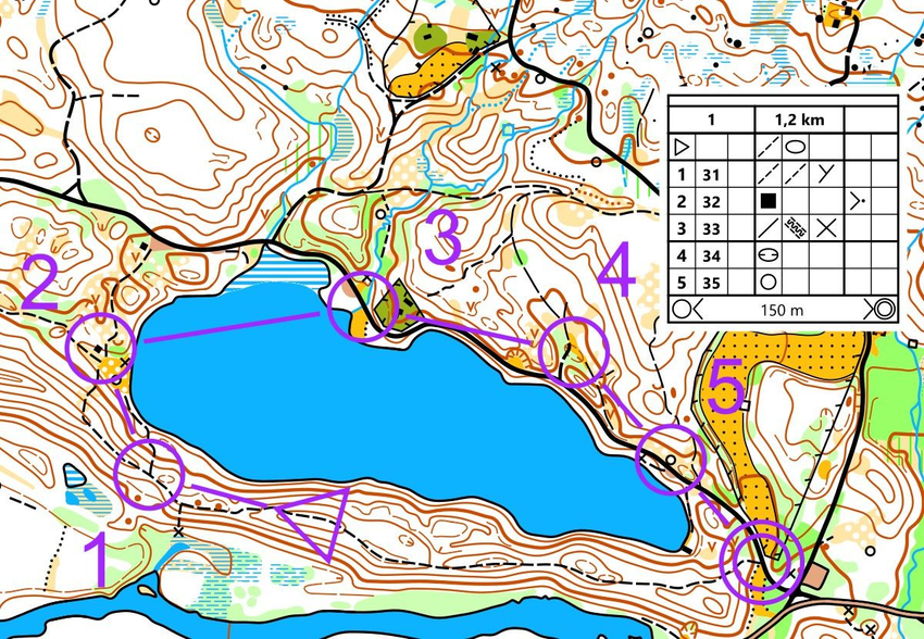
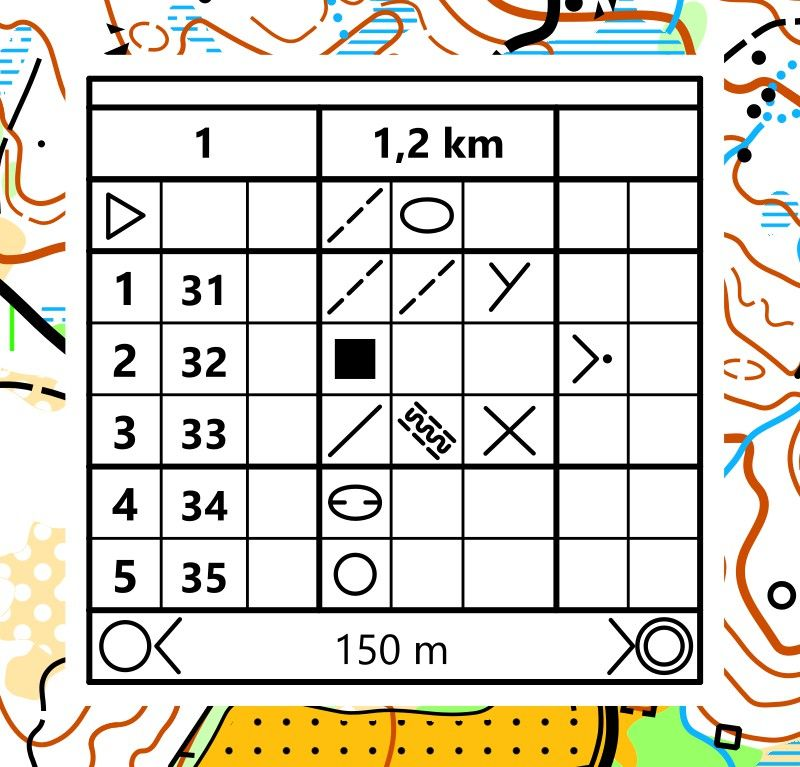
There is often a control description on the map. This list provides information about the controls, such as the control number, the code number, the control feature and the placement of the flag relative to the feature.
Scale
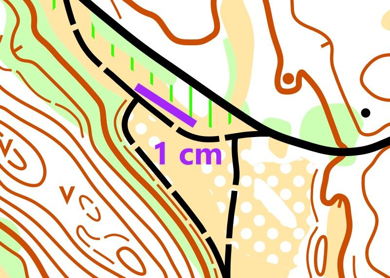
All maps have a scale that tells you how much the map is reduced compared to reality. If the scale is 1:10 000, then 1 cm on the map equals 10 000 cm in the terrain, which is the same as 100 meters.
Orienteering maps usually have one of these scales:
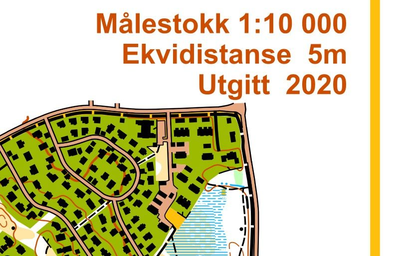
Forest maps usually have a scale in the range 1:7 500 - 1:15 000.
Sprint maps usually have a scale 1:4 000.
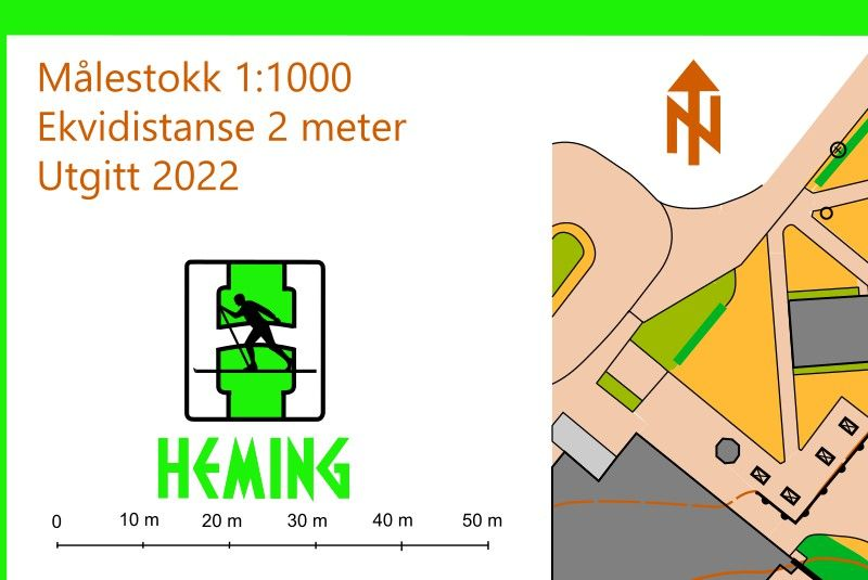
Schoolyard maps usually have a scale in the range 1:1 000 – 1:2 500.
Indoor maps usually have a scale 1:700.
The scale is always shown on the map
The map always shows what the scale is. Often there is also a kind of ruler showing the scale, called a scale bar. On it you can read directly how much a distance on the map equals in reality.
Imagine if the scale were 1:1. Then the map would have to be as large as the entire terrain!

Tips
Cover the last two zeros in the scale and you get the number of meters. On this map the scale is 1:10 000. One centimeter on the map equals 10 000 cm in the terrain, that is 100 meters.
Practice judging distances
The scale converted to meters in the terrain is measured in a straight line. The terrain can be quite steep. The distance in the terrain is therefore always longer than what you measure on the map.
Train your eye to judge distances in the terrain so you can easily estimate whether it is 20 meters, 50 meters or 100 meters to a feature. Do you already have a sense of how long these distances are?
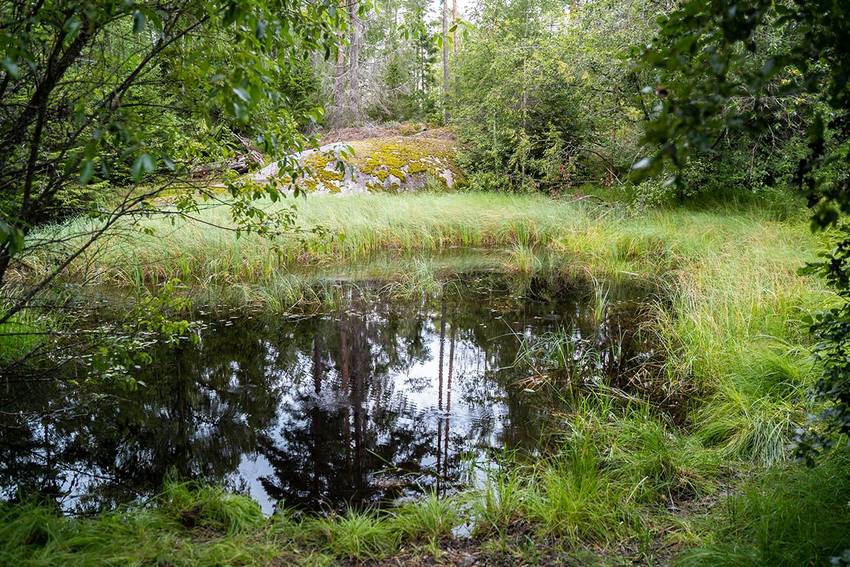
How far is it from where you stand to the top of the knoll behind the pond?
ShowHide answer
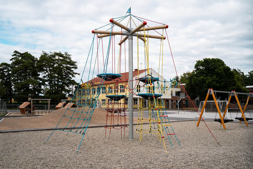
How far is it from where you stand to the school building?
ShowHide answer
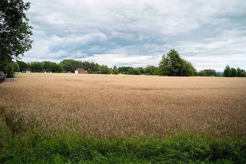
How far is it from where you stand to the red barn on the other side of the field?
ShowHide answer
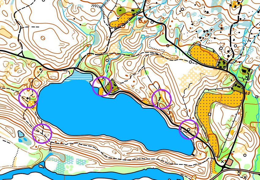
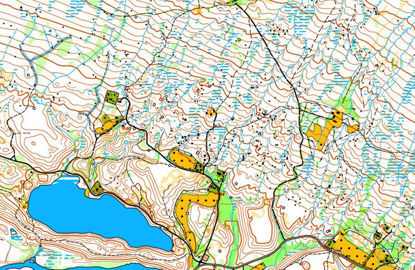
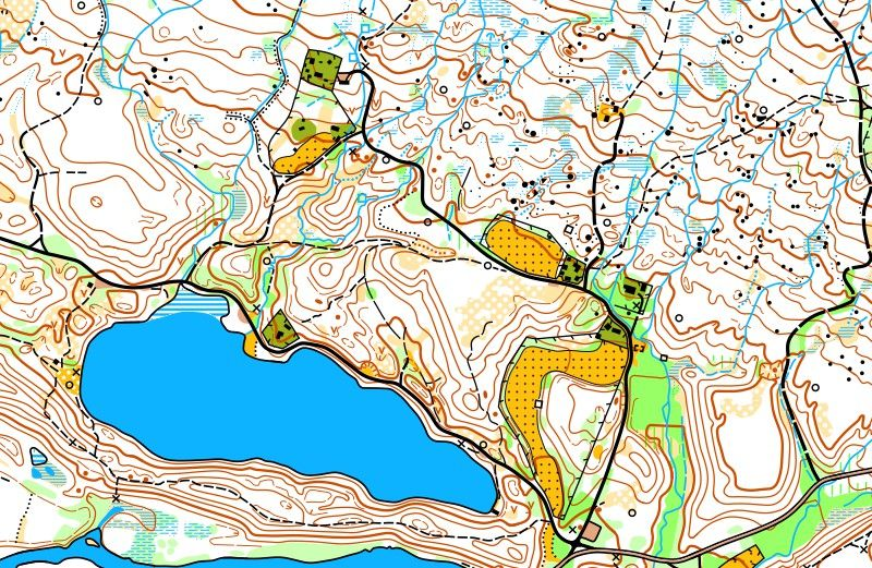
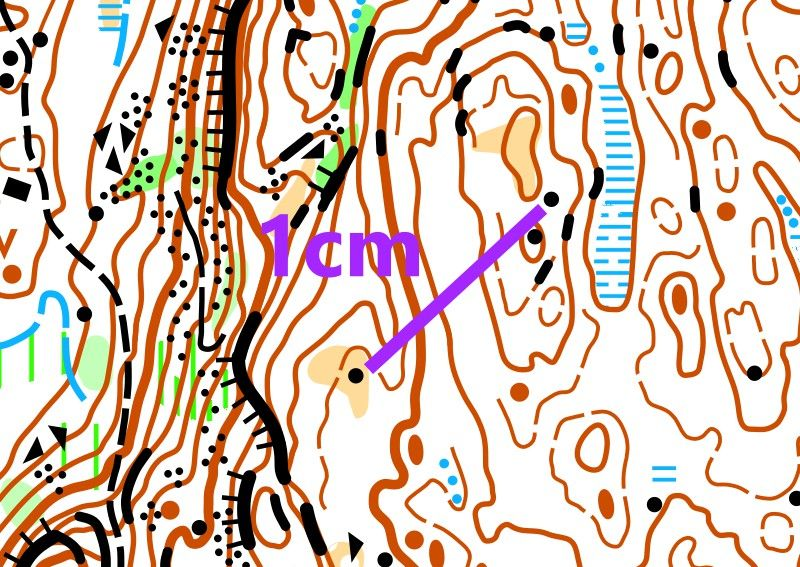
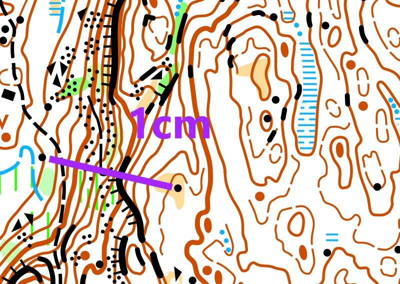
To be able to orienteer well, you must learn to judge distances in the terrain. Here you see two maps with different scales from the same area.The first has a scale of 1:10 000, the second has a scale of 1:5 000.
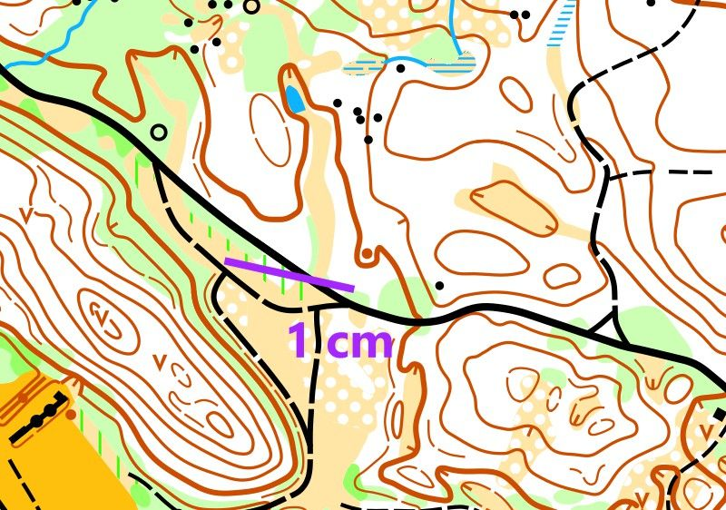
When the scale is 1:10 000, 1 cm on the map equals 100 meters in the terrain.
But when the scale is 1:5 000, 1 cm on the map equals only 50 meters in the terrain.
If you have a map with scale 1:5 000, distances will feel much shorter than with 1:10 000.
What have you learned?
Answer all questions correctly and win a gold medal!
The start of an orienteering course is marked with …
The controls of an orienteering course are marked with …
The finish of an orienteering course is marked with
Where are the controls placed?
When you run an orienteering course, you must find the controls …
If a map has the scale 1:10 000, then 1 cm on the map equals …
Is 1:100 000 a common scale on orienteering maps?
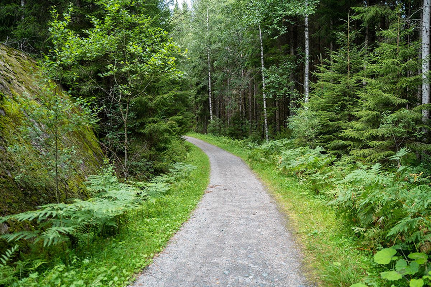
How far is it to where the road turns in behind the spruce tree?