About "The Map"
Here you learn what a map is and how it can show different types of terrain.
Information about the map
The map is a simplified and scaled-down drawing of the terrain, seen directly from above. The terrain can, for example, be a forest, a residential area, a schoolyard, or inside a building. Imagine you are sitting in a helicopter or filming downward with a drone. Then you see the terrain directly from above.
The most important tool
The map is the most important tool when you participate in orienteering. There are several different types of maps intended for different uses - such as mountain maps, nautical charts, city maps, hiking maps, and orienteering maps.
What kind of map is this?
ShowHide answer
Answer:
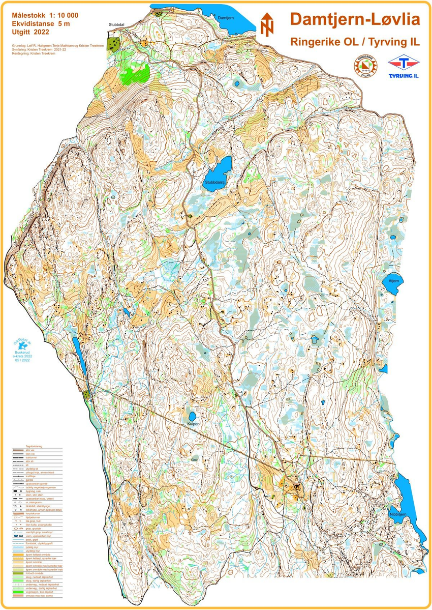
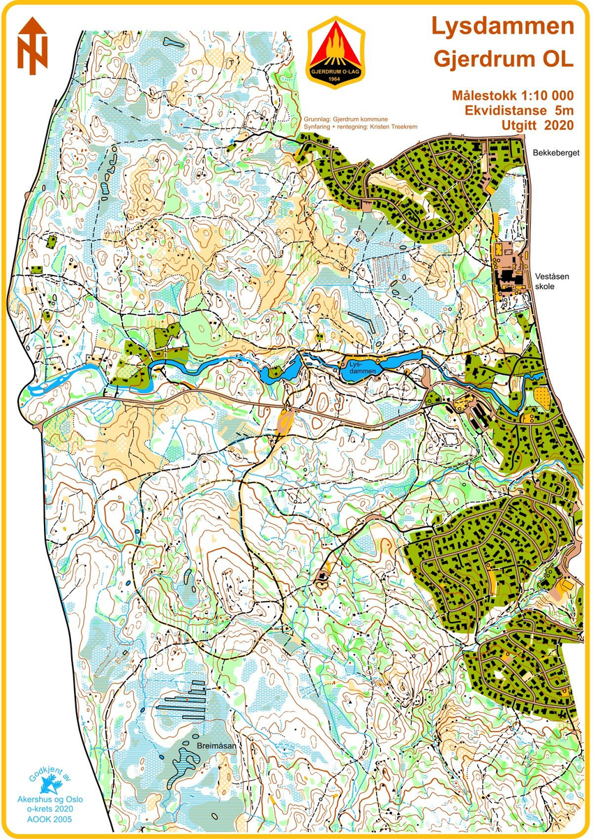
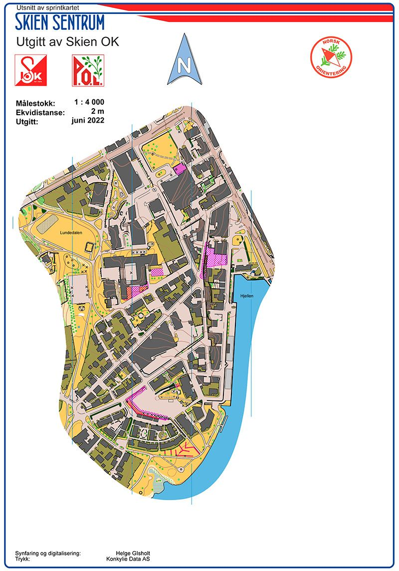
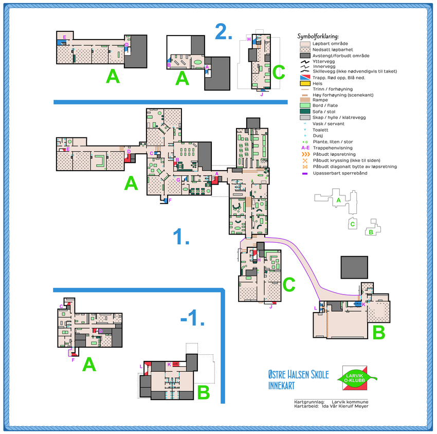
It is an orienteering map. These are also orienteering maps:
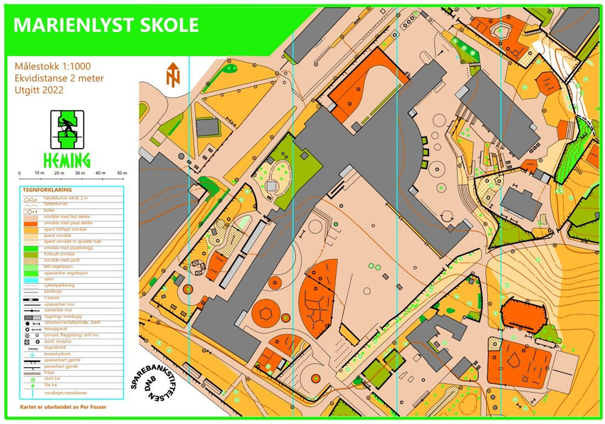

Compare map and aerial photo
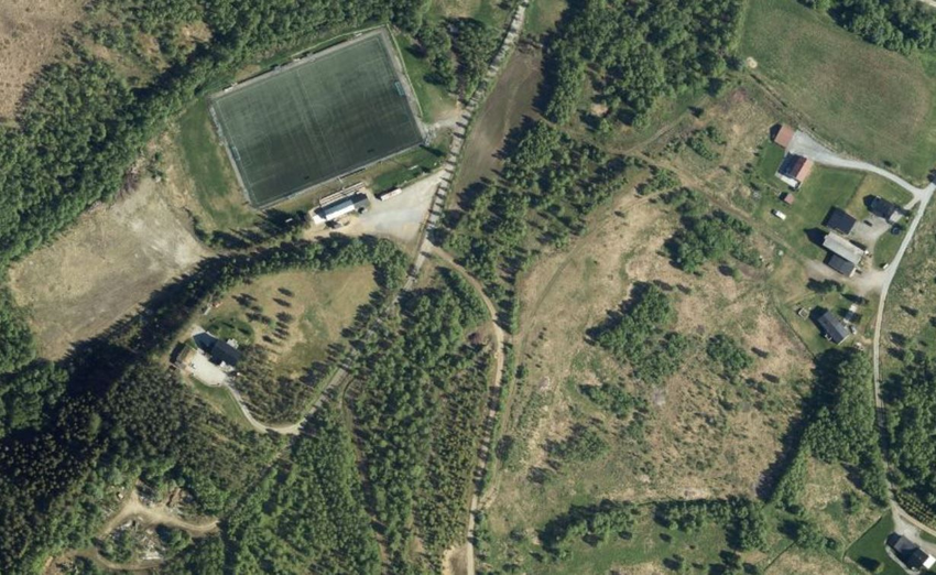
Here is a school area with buildings, playgrounds, some trees, and lawns. Drag the slider to compare the aerial photo with an orienteering map of the same area.
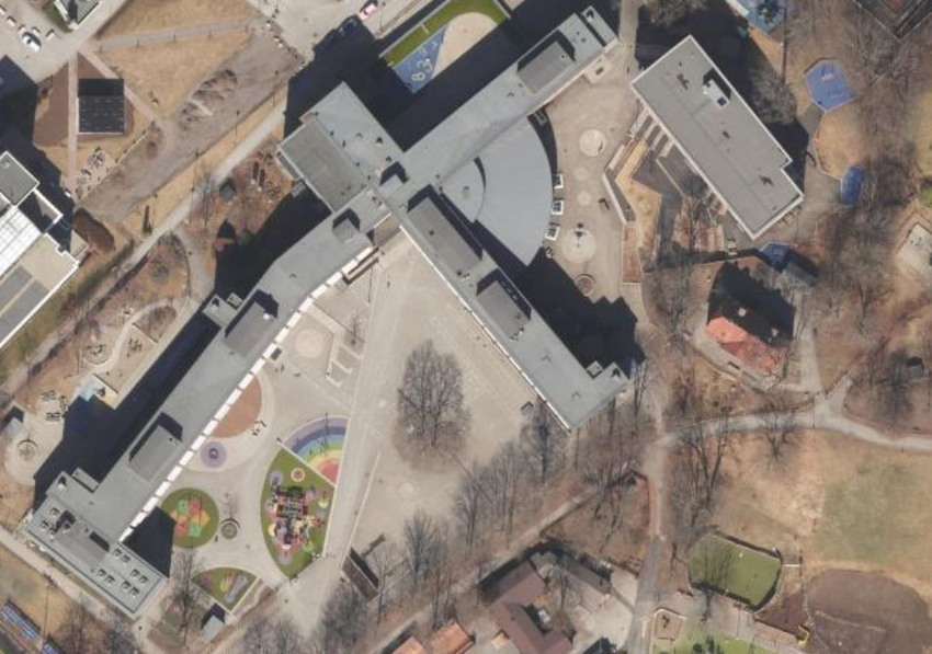
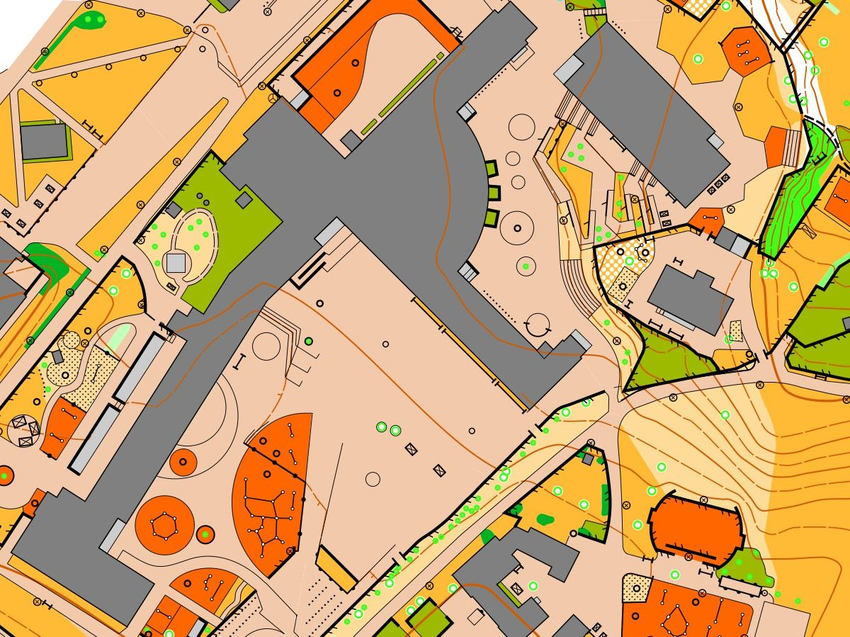
The aerial photo shows the same area as the orienteering map.
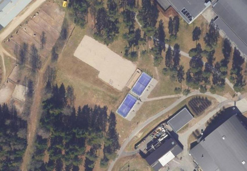
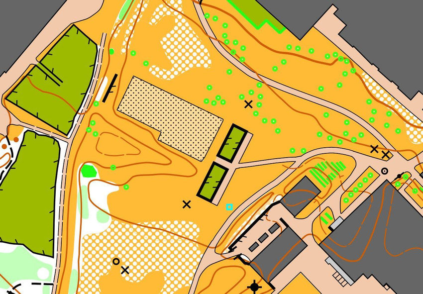
You can learn a lot about maps by comparing the image and the drawing.

Tips
Look after the maps you get when traveling to new places, visiting amusement parks, or museums. It is fun and educational to look at these maps after the trip as well.
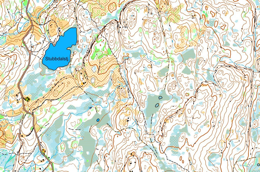
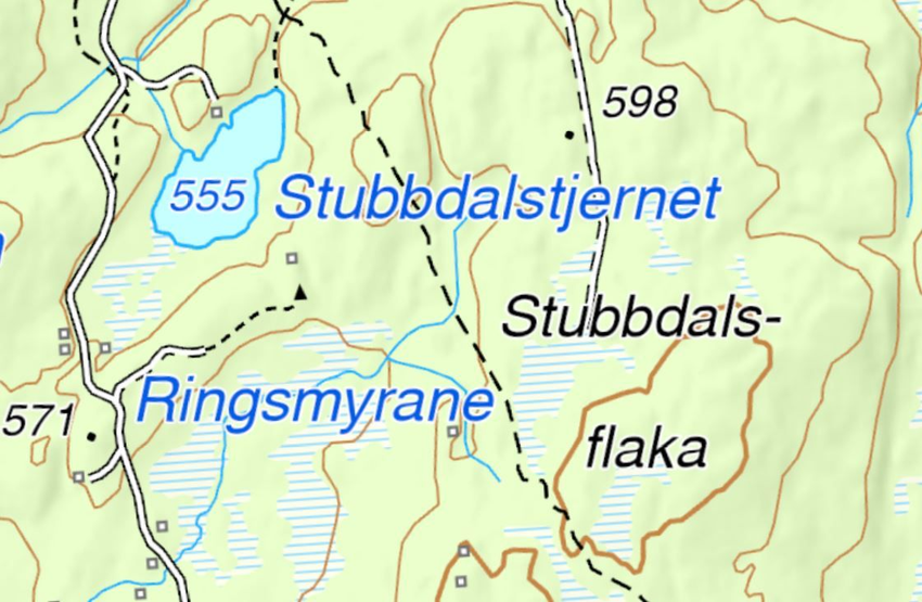
Different types of orienteering maps
Is it the orienteering map or the hiking map that has the most details?
ShowHide answer
Here you can see different types of orienteering maps by clicking the buttons:
-tKBILOsQ7x.jpg)
Orienteering maps show many of the details you can see in the terrain, but not everything. There is not enough space for that. The mapmaker has selected the large and important details and omitted those that are too small and less important.
What have you learned?
Answer all questions correctly and win a gold medal!
What is a map?
The map shows the terrain seen ...
Click on the orienteering map
On the orienteering map there are ...
Which aerial photo corresponds to this map?
Brøttumskole.svgz-S1TmvnAF7W.jpg)
Which map corresponds to this aerial photo?
How detailed are orienteering maps?

Activities
Play: Draw a map (Activity Bank)
With orienteering map: Photo orienteering, star (Activity Bank)